If you read nothing else
- The Fire Mountains were built during the 1730-1736 eruptive period, which buried farmland and forced families off the south west of the island.[1]
- Timanfaya National Park is about 51 square kilometers (20 square miles) in size, and almost all of it is bare volcanic ground.[2]
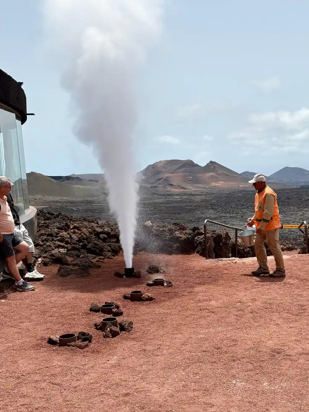
- At Islote de Hilario, temperatures on the surface reach around 250 ºC, and they can even reach more than 600 ºC at 13 m deep.[3]
- Tickets for independent entry to Montañas del Fuego can only be purchased online and for a specific time slot, and the standard adult ticket costs 30.00 EUR.[4][5]
- The full-day tour from this site covers Timanfaya, Cueva de los Verdes and Jameos del Agua, runs 9 hours and has 61 pickup location options.[6]
- Top choice Timanfaya, Jameos & Caves from US$102 Duration9 hours[6]Rating4.47 from 2,662 reviews[6]Guide languagesEnglish, French, German, Spanish[6]StopsTimanfaya, Cueva Verdes, Jameos[6]CancellationFree cancel up to 24 hours[6] Check availability
- Green Lagoon Cruise Tour from US$57 Duration2.5 - 5 hours[7]Rating4.58 from 2,154 reviews[7]Guide languagesEnglish, German, Spanish[7]StopsPark, Green Lagoon, La Geria[7]CancellationFree cancel up to 24 hours[7] See this tour
- Timanfaya Caves with Lunch from US$109 Duration9 hours[8]Rating4.52 from 531 reviews[8]Guide languagesSpanish, English, French, German[8]StopsTimanfaya and caves, with lunch[8]CancellationFree cancel up to 24 hours[8] See this tour
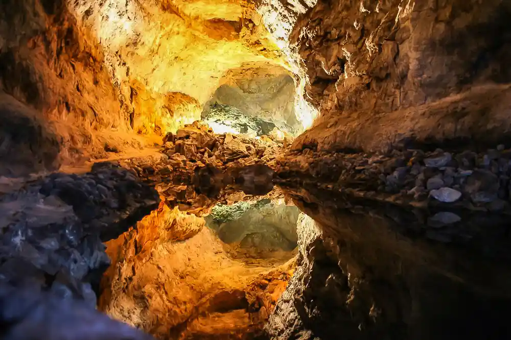
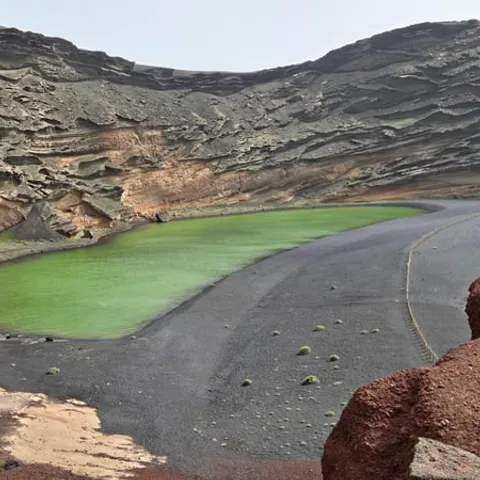
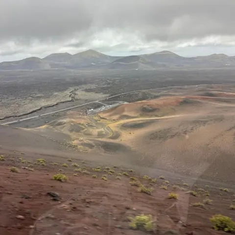
Nowadays, on the surface the temperatures reach around 250 ºC, and they can even reach more than 600 ºC, 13 m deep.
Our verdict on the Fire Mountains
Prepare for the day
- Independent tickets for Montañas del Fuego are online only and time-slotted[4]
- Standard adult entrance to Montañas del Fuego costs 30.00 EUR[5]
- Mancha Blanca visitor centre open Monday to Sunday 9:00 to 16:00[9]
- Line 60 passes through Yaiza between Arrecife and Playa Blanca[10]
When the Earth Opened
The Fire Mountains, the Montañas del Fuego, are the youngest landscape on Lanzarote and the most startling. They were built during the 1730-1736 eruptive period[1], a slow convulsion that opened the ground in the south west of the island and kept it open for years. What had been farmland and pasture became a field of black cones, ash and cracked lava. Villages were buried or abandoned, and the families who farmed the low ground moved away and started again somewhere else.
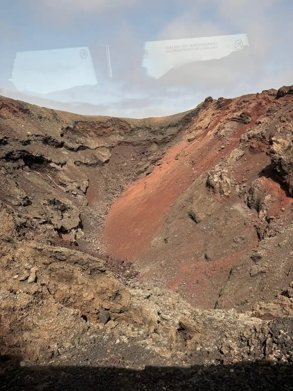
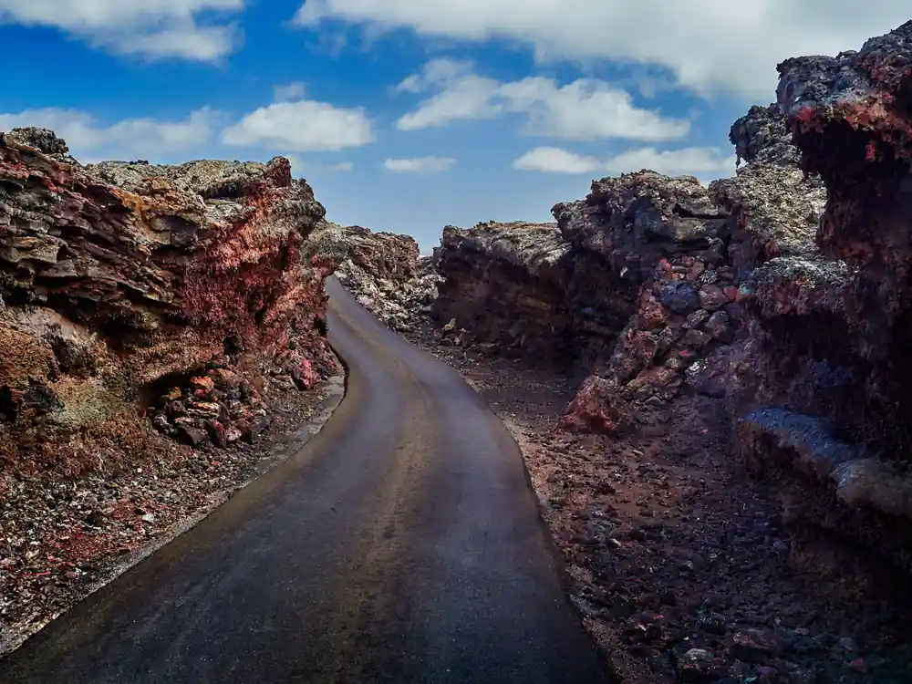
Standing out there today, the scale of it takes a while to sink in. The surface is not one smooth black sheet but thousands of broken pieces, some sharp as glass, some soft as gravel, with red and ochre patches where the rock carries more iron. Cone after cone rises out of the plain, each one a single vent that blew for a while and then stopped. There are no trees, no streams and no fields, and the quiet is total apart from the wind. It looks less like countryside than like a building site abandoned halfway through.
Lava, Ash and Exodus
A volcano with lava coming out is one thing on a screen and quite another when it is a few kilometres away. The eruption of 1730-1736[1] did not simply pour lava. It threw ash and red hot rock into the air, opened fresh cracks in the ground and sent streams of molten stone downhill towards the coast. Ash settles on fields, roofs and cisterns and chokes them. Livestock die, water turns to grit and crops fail. For the families in the path of it, the choice was to leave or to stay and lose everything.
The eruption redrew the map of the island. Lava covered fields, tracks and wells, and the villages that survived grew as others emptied into them. Islanders kept the story in the names they gave the cones and in the fields they worked around the edges of the flow, and generations later farmers were still turning up ash in the soil. The ash that smothered the old farmland is the ground the vineyards of La Geria are planted in today, and the vines grow in hollows scooped out of it, one to a pit, sheltered by low walls of stone.
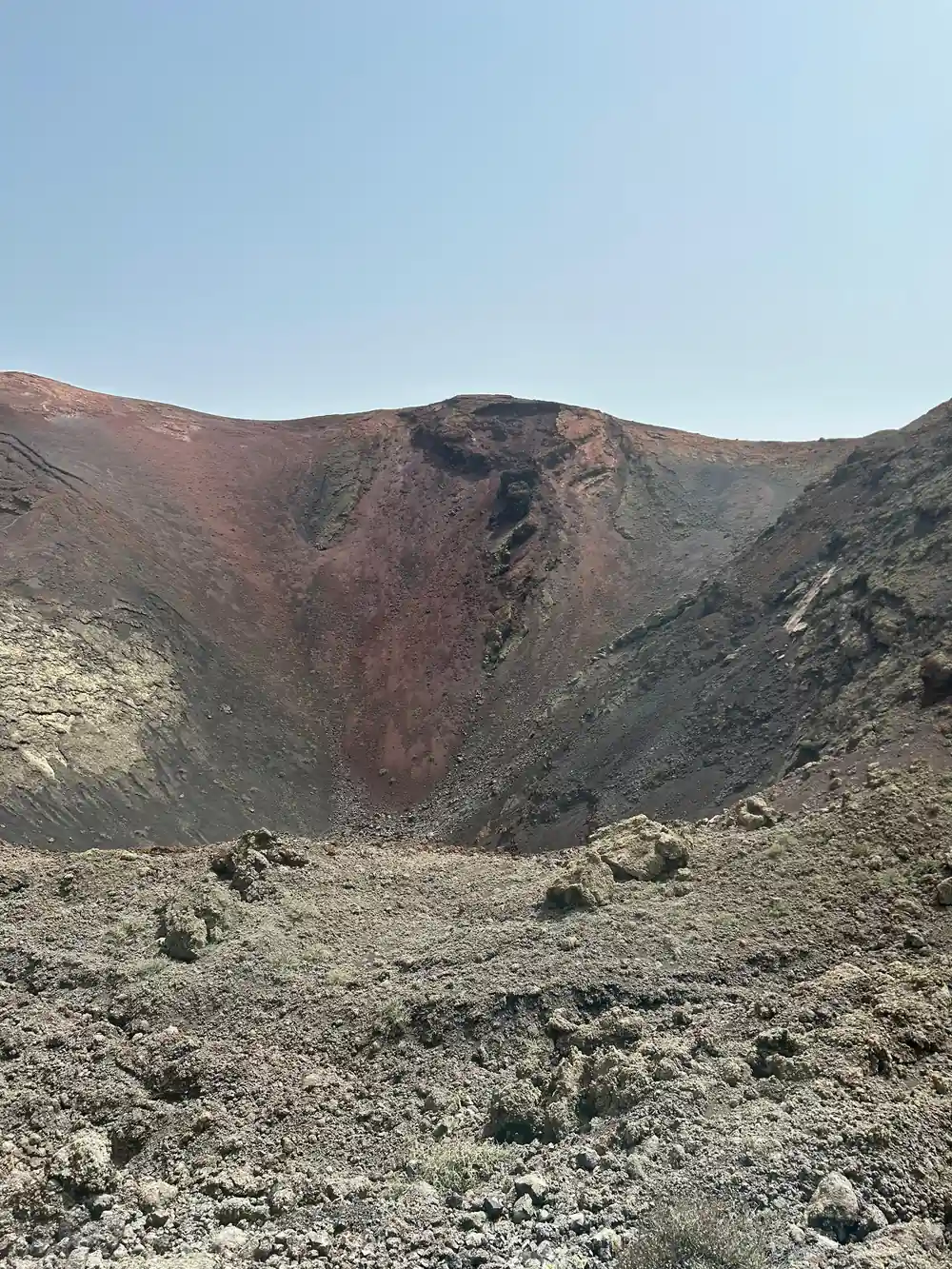
Black lava, red ash and a sky that does not seem to belong to Europe
How the Fire Mountains Were Born
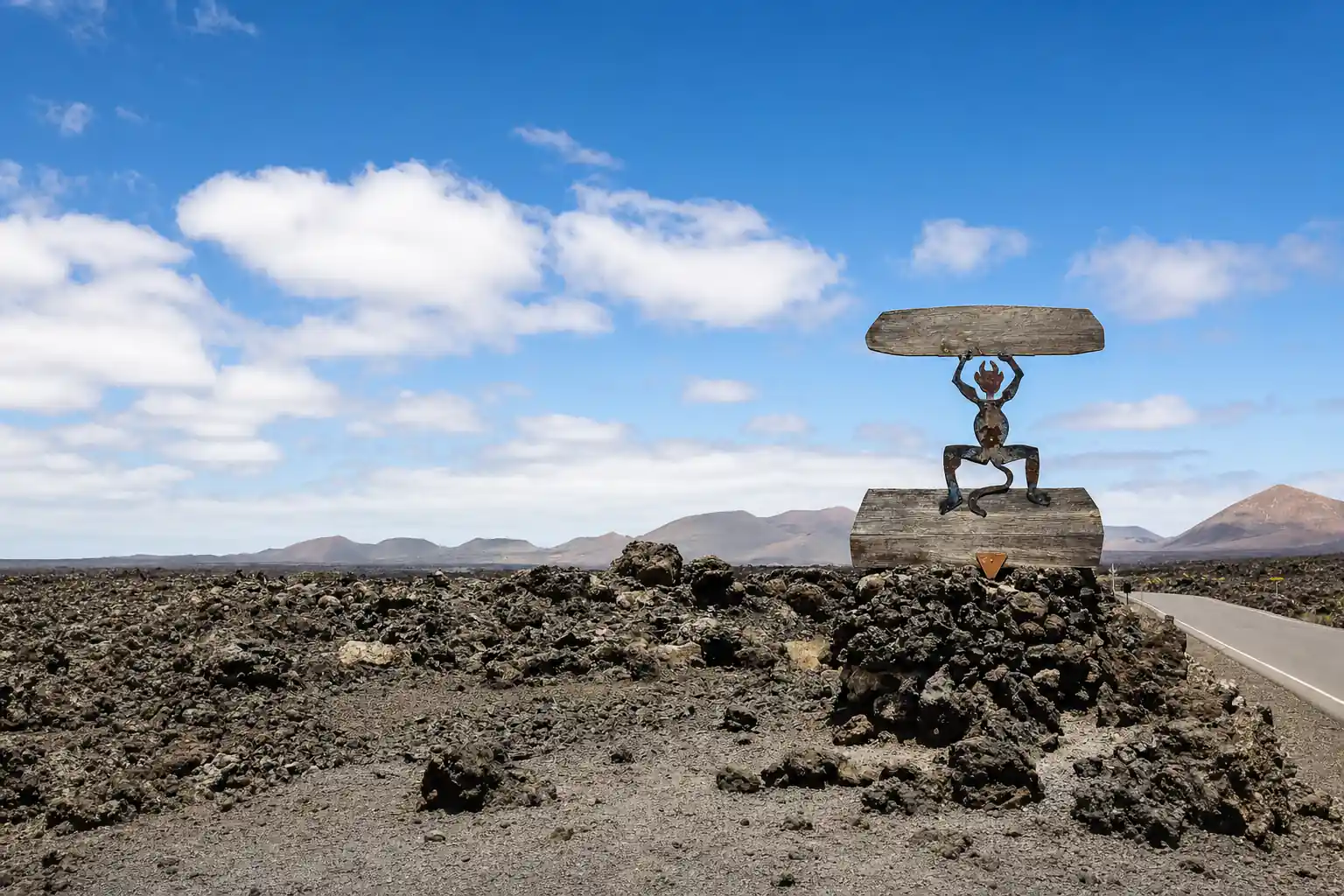
How many Lanzarote volcanoes there are depends on how you count them: separate cones, vents strung along a single fissure, or the whole island as one volcanic edifice. In the Fire Mountains you are looking at a chain of cones and craters that grew along lines of weakness in the crust, where molten rock from deep below found a way up. Runny lava travelled a long way and flattened into broad sheets; thicker lava piled up into steep, rough cones. Timanfaya National Park is about 51 square kilometers (20 square miles) in size[2], and almost all of it is bare volcanic ground.
The colours come from the rock itself. Basalt that cooled fast at the surface is dark grey or black, while the ash and cinders that fell around the vents stayed loose and light enough to blow about. Iron rich layers oxidised and turned red, ochre and orange, and you can read the sequence in the wall of any cutting beside the road. Some of the lava still holds the bubbles of gas that were trapped in it as it froze.
Life Takes Hold on Bare Lava
Facts about Timanfaya National Park tend to come down to rock, heat and time, and this is where the time shows. Bare lava is a hard place to make a living, and life arrives slowly. First come the grey and green lichens that grip the rock and break it down grain by grain, then mosses in the shade of stones, then low shrubs that can take salt wind and almost no soil. Look at the edges of the flow, where it meets older ground, and the green is thicker. Out in the middle, a few tough plants live on moisture that condenses overnight.
Farmers worked around the lava rather than on it. In La Geria, growers dug hollows into the ash and planted a single vine in each, sheltering it behind a low wall of stone, and the ash holds what little moisture the wind brings. It is an unusual wine landscape, a pattern of scoops and crescents across the black ground, and it shows best in low light, when the rows throw long shadows and the ash looks grey rather than black.
from US$102
The full-day tour from this site links the Fire Mountains with the caves at Jameos del Agua and Cueva de los Verdes, with pickup across the island.
Geothermal Heat: Still Hot Today
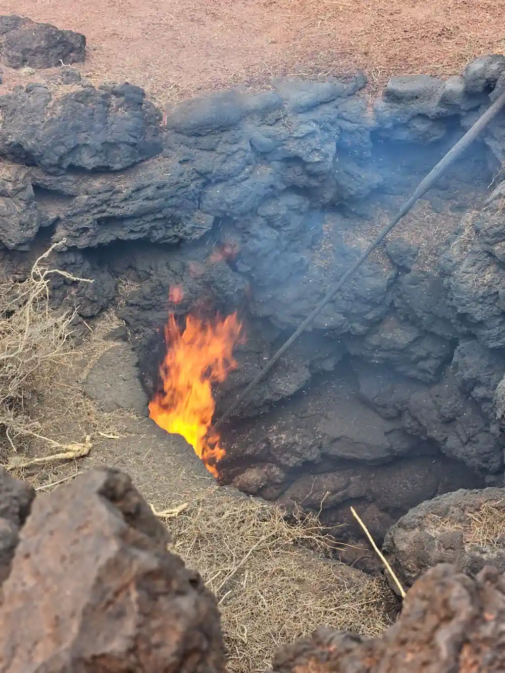
A few Timanfaya National Park facts are worth carrying with you when you go. The heat that drove the eruption has not gone away. At Islote de Hilario, temperatures on the surface reach around 250 ºC, and they can even reach more than 600 ºC at 13 m deep.[3] That is the simplest way to understand the Fire Mountains: the rock looks cold and feels warm, and the warmth is only a spade's depth away.
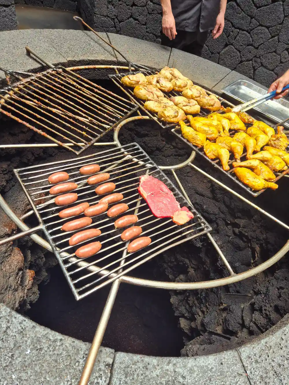
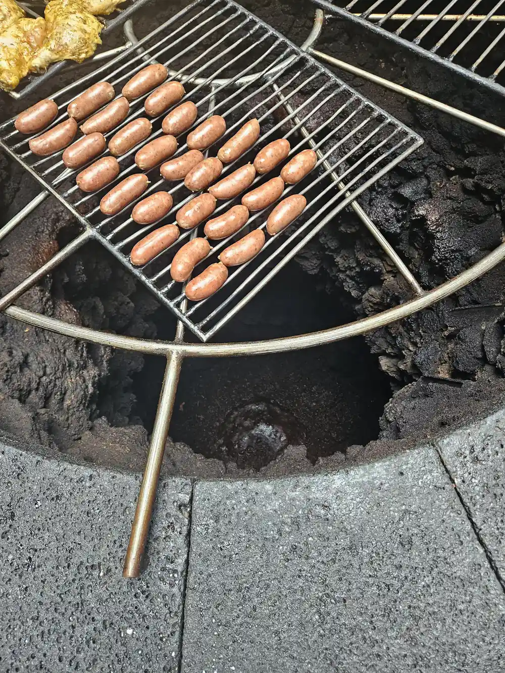
El Diablo, the restaurant up at the site, takes that heat one step further. Its grill sits over an open cavity in the rock and uses natural heat from the subsoil, where temperatures exceed 600 °C just 15 meters below the surface. Meat and vegetables cook there without fire or electricity.[12]
Is Timanfaya Still an Active Volcano?
Timanfaya became a National Park by a decree of August 9, 1974, published in the Official State Gazette on September 17, 1974[13], and that protection shapes almost everything about how you visit. Whether the volcano counts as active or dormant is a question of definitions rather than a simple yes or no, and the warmth still coming off the ground is why people keep asking. What is certain is that the landscape is young, bare and still warm underfoot.
The other planet quality of the place has not gone unnoticed. Several films inspired by other planets have been filmed in Timanfaya, including Enemy Mine, Krull, Mission Stardust, Stranded and Operation Ganymed[14]. Stand on the rim of a crater with the wind coming off the black plain and it is easy to see why. A guide helps most here, pointing out the different flows and the cones, and keeping an eye out for the small signs of life between the stones.
Planning Your Visit to the Fire Mountains
Getting the practical side right makes the rest of the day easy. Tickets for independent entry to Montañas del Fuego can only be purchased online and for a specific time slot[4]. Choose your slot before you travel. The standard adult entrance ticket costs 30.00 EUR[5]. Before you drive up, stop at the Centro de Visitantes e Interpretación de Mancha Blanca, which gives free access to its exhibition and audiovisual programme[15] and is open Monday to Sunday from 9:00 to 16:00[9].
Puerto del Carmen and Timanfaya National Park are about 22 km apart directly, with a road distance of about 23.5 km[16]. It is an easy run by hire car, and guided tours cover it for you. Public transport will not put you at the crater: Line 60 passes through Yaiza on its route between Arrecife and Playa Blanca[10], and from there you still need a tour or a car. Coaches collect from pickup points all over the island, and the full-day tour from this site has 61 pickup location options[6].
Once you are in the park, the Route of the Volcanoes has adapted coaches[11], so the coach loop works even if you cannot walk far. On the edge of the park there is a short camel ride that lasts approximately 20 minutes[17]. Bring closed shoes, water and a windproof layer. The lava is rough underfoot, shade is scarce and the wind rarely stops.
How hot the ground still is
At Islote de Hilario, temperatures on the surface reach around 250 ºC, and they can even reach more than 600 ºC at 13 m deep[3]; El Diablo's grill uses subsoil heat where temperatures exceed 600 °C just 15 meters below the surface[12].
From-prices for Fire Mountains tours
Adult from-prices per person from these GetYourGuide listings[6][7][8]. No child from-price is listed for them, so confirm child places with the operator when you book.
When to visit the Fire Mountains
Plan the Fire Mountains day
Book your slot early
Independent tickets for Montañas del Fuego are online only and tied to a time slot, so fix a time before you travel.[4]
Pick your base
Puerto del Carmen sits about 22 km from the park in a straight line, with about 23.5 km of road between them.[16]
Bring the right kit
The lava is rough underfoot and shade is scarce. Trainers or walking shoes, a hat, water and a windproof layer cover most days.
Add the caves and vines
The full-day tour from this site joins Timanfaya with Cueva de los Verdes and Jameos del Agua, and it runs 9 hours.[6]
Start at the visitor centre
Mancha Blanca's centre is open Monday to Sunday from 9:00 to 16:00, with free access to its exhibition and film.[9][15]
See Timanfaya, Jameos del Agua and Cueva de los Verdes in one day
from US$103Reserve now & pay later